Logan Skaret Pavement Pro · 2024 – 2026

Walk the lot.
Get the takeoff.

The problem. Contractors in the pavement maintenance industry still bid from site walks, tape wheels and satellite photos. This traditional method takes hours, misses key details and leaves a number nobody can check.

My solution: Pavement Pro. An all-in-one scan-to-bid pipeline that speeds up the estimating process. It gives contractors ready-to-price quantities they can verify and bid from directly. One walk of the lot with a handheld scanner replaces the tape wheel, the photos and the guesswork. I’ve been building this for two years, and it’s finally ready to show.

  • AI that finds the features. The app uses AI to pick out what is on the lot: pavement, curbs, stall lines, symbols, cars and trees. I trained a custom SAM 3 pipeline on synthetic parking lots I generated myself, each with an exact answer key.
  • Tested on real parking lots. On three real lots, each walk came back to within 4 cm of where it started, and the app found the stall lines in the real scans.
  • A demo version, with much more to come. What you see here is a demo. Next come a lot checked by hand against a takeoff, pavement condition such as cracks and patches, and priced bids.
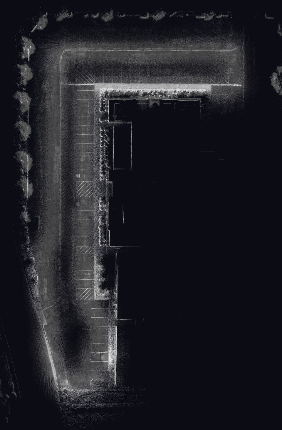
Top view of a real parking lot from the laser scanner: an L-shaped lot around a building, with stall lines, hatched accessible aisles and trees, shaded by how strongly the laser bounced back.
A real lot, scanned 10-25-26 at dusk. A 6½-minute walk, 8.35 million points, with centimeter GPS throughout (F-007). The picture is the scan seen from above, shaded by how strongly the laser bounced back; the button shows the stall lines the app found on its own. Not yet checked against a takeoff done by hand. Measured in feet; no map location is shown.
Video 1 min

Pavement Pro in one minute

From a walk of the lot to the bid quantities: the handheld scanner, the app finding features with AI, and GeoSynth, the simulated parking lots it learns from.

Its own page, to share: pavementpro.online/video

How it works 01

One walk in, a bid out

  1. 01

    Capture

    Walk the lot once with the handheld scanner. It records lidar, camera and centimeter GPS together.

  2. 02

    Process

    The app stitches the walk into one 3D scan, and its AI picks out the pavement, paint, curbs and symbols.

  3. 03

    Verify

    The estimator checks what was found in 2D and 3D, and fixes or adds anything missed.

  4. 04

    Export

    The quantities come out as a spreadsheet: square feet, linear feet and counts, by bid item.

  5. 05

    Price

    The contractor’s own rates turn the quantities into the bid.

Each step in more detail, and the data pipeline inside the app: on the Documents page.

Try it 02

Run a takeoff yourself

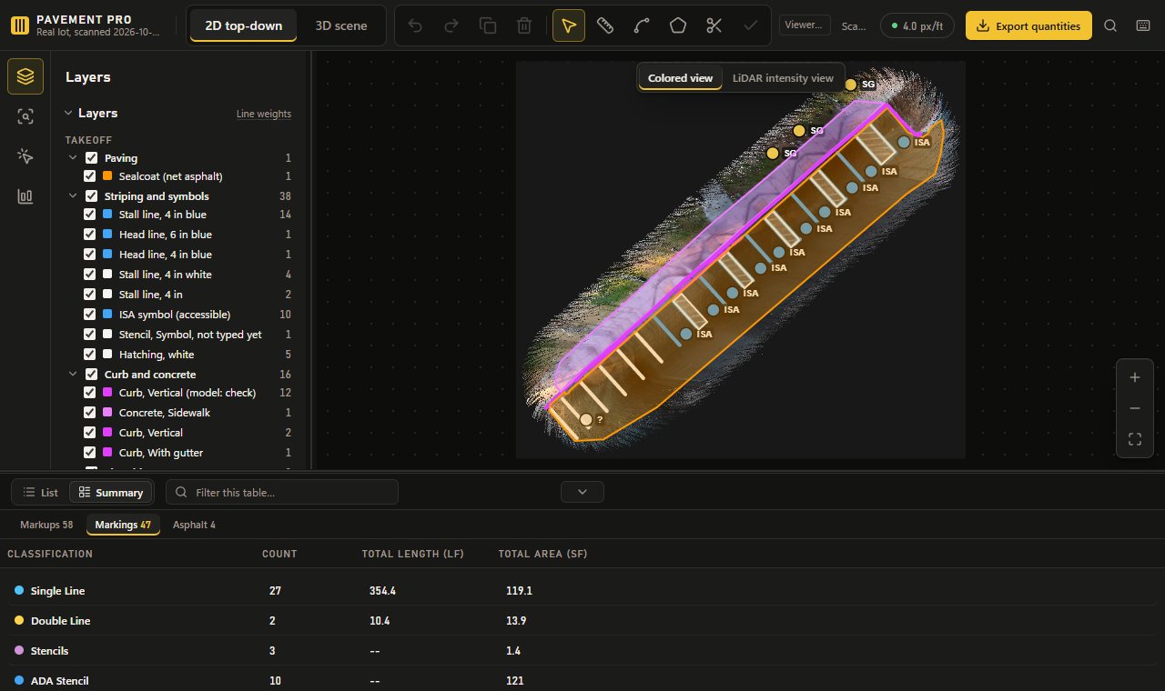
The Pavement Pro workspace runs in your browser, nothing to install: a real captured lot from 10-26-26 and four simulated GeoSynth lots. Pan and zoom the plan, turn layers on and off, look at the lot in 3D, select what the app found, and export the quantities.

Try the demo

The Pavement Pro workspace showing the real lot’s takeoff: the plan with the found stall lines and the bid items table.
Career 03

From the field to the estimator’s desk

I’m Logan Skaret. I’ve run equipment on GPS machine control, estimated and sold paving and striping work, and now take off heavy civil and solar bids. Each job showed me a piece of the problem Pavement Pro solves.

loganskaret@gmail.com

  1. Jun 2021 – Dec 2023

    Equipment operator

    A heavy civil excavation contractor

    Ran a scraper and a skip loader on laser and GPS machine control, building to civil plans. Set grade with an RTK rover, rotating lasers, eye levels and a tape.

    What it gave the project: trust in machines that measure, and the habit of checking them. The RTK pods and the rig’s calibration come from here.

  2. Jan – May 2024

    Career break

    A semester at Reedley College, full time.

  3. Jun 2024 – Oct 2025

    Estimator and salesperson

    A paving and striping contractor

    Grading, earthwork and paving under $5M, and private sealcoat and striping work, taken off by hand: tape wheels, satellite photos and stall counts on a screen. Met customers on site to set scope and price; won about 30% of bids.

    What it gave the project: the problem itself. A takeoff took hours and still missed detail, so Pavement Pro measures what an estimator bids: square feet of sealcoat, linear feet of stripe, stalls and symbols.

    • 2025
      The first version: a desktop app reading satellite images, with a U-Net, then DINOv3.
  4. Oct 2025 – now

    Estimator

    A heavy civil and solar contractor, on $10–80M bids

    Quantity takeoffs, pricing, subcontractor quotes and production rates in Bluebeam, Excel and HCSS HeavyBid.

    What it gave the project: the need for volume. Bidding many different jobs showed how wide the range of sites is, and that a model has to see far more lots than anyone could scan and label by hand to handle them all. That led to GeoSynth: simulated parking lots generated in any number, each with an exact answer key to train and test against.

    • Nov 2025
      GeoSynth begins: a generator of parking lots to make labeled training images.
    • Feb – Apr 2026
      A web app on a fine-tuned SAM 3, still on satellite images.
    • May – Sep 2026
      The scanner designed in Fusion 360.
    • Sep 23, 2026
      A charter, one repository, and a written memory for the AI agents that write the code.
    • Oct 2026
      The Windows app, scanner v5, RTK pods, and the first real lots scanned and taken off.